Live demos
See the platform, not a PDF.
Every deliverable below is a real, interactive piece of software — not a screenshot. This is what a buyer, lender, or architect gets when you forward them a link. The ortho, terrain, 3D mesh, fly-through tour, roof/solar footage, and parcel boundary are all real — capture, photogrammetry, and county record, not renderings or approximations (each layer says which, in its own legend). A real engagement runs all of it against your actual property.
Property Intelligence — 2806 Prado, layer by layer
A real survey pass on one specific property — ours — draped on a satellite base, toggleable, opacity-controlled. Every raster layer below is cropped to this parcel's own footprint before it ever reaches the browser, not just panned-away-from — this platform doesn't surface a neighboring property's imagery without that property's own engagement.
- Orthomosaic
- Real nadir + oblique aerial imagery, stitched into one georeferenced top-down photo — cropped to this parcel's own recorded boundary.
- Terrain hillshade
- Relief shading derived from the reconstructed surface model — where the ground actually rises and falls.
- Elevation contours
- 2.5m contour lines generated directly from that same reconstructed surface — a real, if approximate, elevation read.
- Parcel footprint
- The actual recorded lot line from Travis County's own parcel records — not a reconstruction guess. Still not a substitute for a licensed boundary survey.
- FEMA flood zone
- Zone X — an area of minimal flood hazard, not a Special Flood Hazard Area (FEMA National Flood Hazard Layer, queried live for this parcel).
3D model viewer
Orbit and inspect a property's photogrammetry mesh directly in the browser — no download, no plugin.
Terrain, gamified
The same real elevation data, rendered as blocky voxel terrain — drag to orbit. A fun side effect of having the real DSM in hand, not a deliverable on its own.
Fly-through tour
An interactive, video-Matterport-style walkthrough — click through rooms via the floor plan or the doorway controls. Real capture, 2806 Prado, 2026-08-06.
Roof & solar inspection
A close, slow pass along every ridge and valley, plus a clean top-down of the full panel array — the actual footage a roof/solar condition read is built from. Real capture, 2806 Prado.
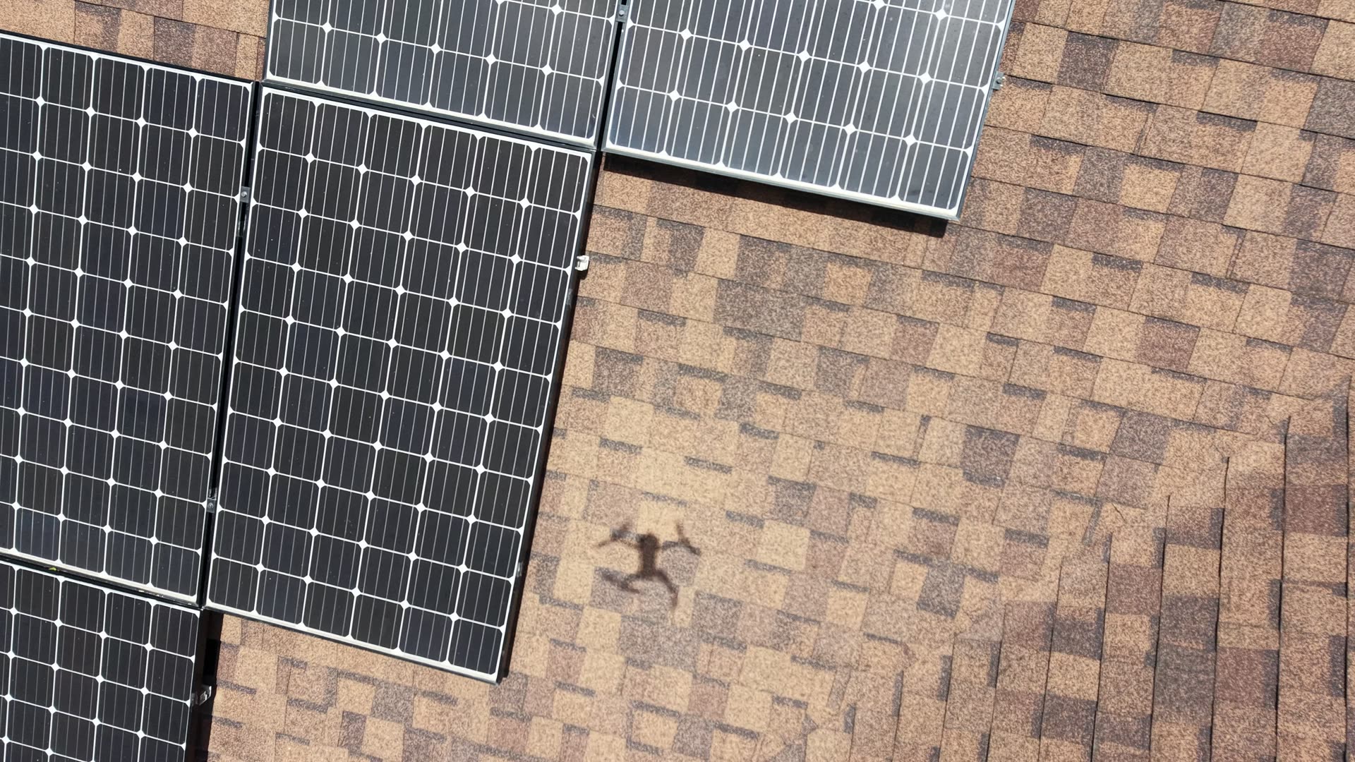
Visual condition only — no thermal payload in the fleet yet, so this isn't hot-spot/dead-cell detection, just what a slow, close pass actually shows.
Every one of these against your actual property, delivered as a link you can forward.
← Back to pricing