Desktop Property Intelligence — real capture, not a rendering
De-risk a property before you buy it — for a fraction of a survey.
Parcel + terrain + fresh aerials, fused into an interactive report you can forward to your architect, lender, or partner. Not a PDF — a link.
What we do
Four lanes, priced separately, on purpose
Property Intelligence
Parcel + terrain + fresh aerials, fused into a decision-support report.
Listing Media
Stills, video, and interactive fly-throughs for real-estate listings.
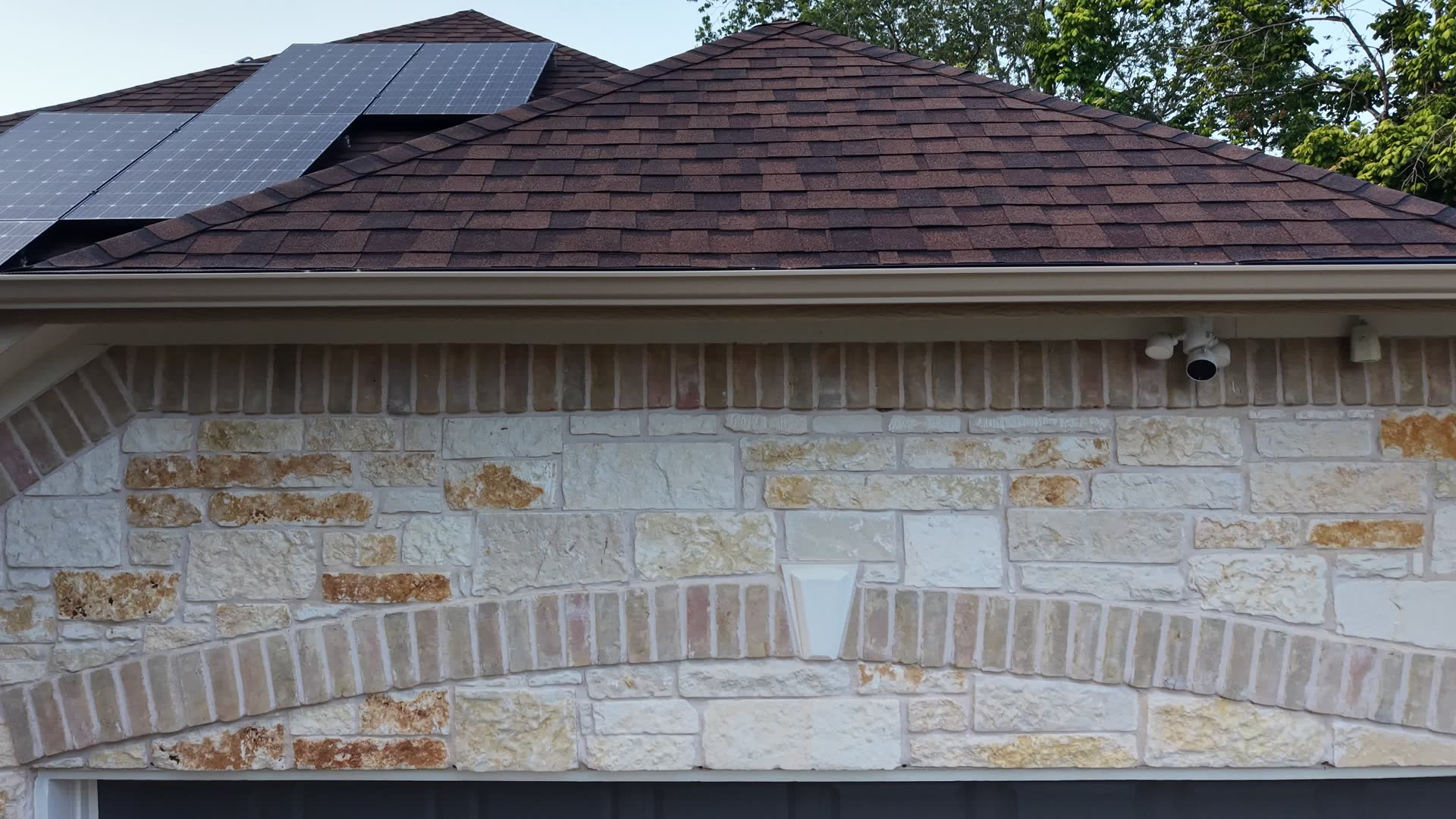
Roof & Solar Inspection
Close, slow passes for a visual condition read — not a guess from the ground.
Scenery & Reels
Stock licensing and custom scenic shoots for reels, titles, and b-roll.
Pricing
Property-Intelligence ladder
Pre-purchase decision intelligence — a fast, cheap first look before (and to scope down) a stamped survey. Never a substitute for one.
Desktop Report
$299–499
per parcel
Flight-free — orderable nationwide
Land buyers/investors screening a parcel sight-unseen, in a 7–14 day option window.
- Parcel + county GIS fusion
- USGS 3DEP slope/drainage/buildable screening
- FEMA flood + access read
- Shareable interactive viewer
- Under 72hr turnaround
On-Site Report
$900–1,500
per parcel · band by acreage
A real flight — Austin/Omaha
Custom-home builders, buyers under contract, small developers.
“$1,200 to de-risk a $400k buy, before a $4–6k survey.”
- Everything in Desktop Report
- Fresh nadir + oblique flight, orthomosaic
- Current imagery fused to terrain/parcel
- Written qualitative buildable/slope/drainage/access read
Land & Dev Feasibility
$2,500+
scoped / project
A real flight — Austin/Omaha
Developers, multi-lot / subdivision diligence.
- Everything in On-Site Report
- Scoped to the project — ask for a quote
Add-ons: fly-through tour $150–300 · twilight/cinematic $150–250 · Desktop investor bundle $249–349/report at 5+ · rush turnaround $100–200.
Real example, not a mockup
This is the On-Site Report flight, for real
A property under consideration for purchase — flown with the owner's permission before an offer went in. The descent alone tells you more about terrain, access, and what's actually out there than a listing photo ever will.
Also real, also new
Roof & solar inspection
A close, slow pass over every plane, ridge, valley, and penetration — plus the full array, row by row. A visual condition read your insurer, buyer, or HOA can actually look at, not a guess from the ground.
Visual condition only for now — no thermal payload in the fleet yet, so we don't claim heat-based hot-spot detection until that hardware exists.
First inspection samples are rolling out now. See the real roof/solar capture →
Ask about an inspectionWhat you're actually paying for
The underlying terrain data (USGS 3DEP) and parcel data (county GIS) are free — we don't pretend otherwise. What you're paying for is synthesis, judgment, a fresh flight, turnaround, and the interactive viewer itself — the one thing a commodity stills-shooter can't hand you.
Every intelligence deliverable is screening-grade — qualitative, ~1–3m, and never a substitute for a licensed boundary survey.